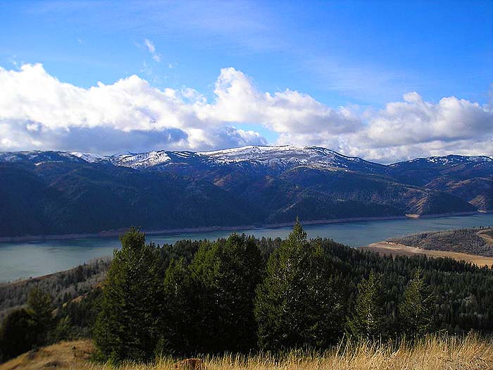
Palisades Reservoir is formed by Palisades Dam, which is a significant feature on the Palisades Project.
Palisades Reservoir
- Recreation on this 25 square mile (16,100 acre) reservoir with 70 miles of limited access shoreline is administered by the Caribou-Targhee National Forest.
- Located in scenic southeast Idaho and west-central Wyoming, east of Idaho Falls. Palisades’ fish species include cutthroat and brown trout, kokanee and mackinaw.
- The fishing season is year-round, but fluctuations in the reservoir level during the summer months result in inconsistent fishing.
- Spring, fall, and winter ice fishingare the most productive. Reservoir acre feet and total reservoir capacity and cubic feet/second release rates for rivers below Upper Snake River Basin reservoirs and select river locations are updated daily and graphically provided.
- The location offers restrooms, boat ramps, and campgrounds.
- The information available at Idaho Falls Interagency Visitor’s Center at 208.523.3278.
![]()
Directions to Palisades Reservoir
The reservoir is located along U. S.Highway 26 near the Idaho and Wyoming borders.
![]()
Address
Caribou-Targhee National Forest420 Bridge St. *Saint Anthony, ID83445.
Latitude: 43.211182
Longitude: -111.132889
![]()
Other Nearby Parks
- Fossil Butte National Monument.
- Grand Teton National Park.
- John D Rockefeller Jr Memorial Parkway.
- Jackson National Fish Hatchery.
- Eastern Idaho Visitor Information Center.
- Gros Ventre Wilderness Area.
- National Elk Refuge
- Trail Creek Bridge Campground.
- Dike Lake Campground
- Pipeline Campground
- McClendon Spring Campground
- Blackfoot River
- Redpoint Campground
- St. Anthony Sand Dunes.
- Hawkins Reservoir Campground
- Goodenough Creek Campground
- Blowout Campground
- Cutthroat Trout Campground
- Sage Hen Flats Campground.
- Scab Creek Trailhead Campground.
- Upper Green River Recreation Area.
- Warren Bridge Campground
- New Fork Campground
- Pine Creek Ski Area.
- Fontenelle Creek Recreation Area.
- Tailrace Campground
- Slate Creek Campsites
- Names Hill
- Bear Lake State Park.
- American Falls Reservoir
- Island Park Reservoir
- Ririe Reservoir
- Fontenelle Reservoir
- Caribou National Forest and Curlew National Grassland.
- Targhee National Forest
- Bridger-Teton National Forests
- Shoshone National Forest
- Hells Half Acre Lava Flow.
- Jackson Lake Boat Ramp.
- Bear Lake National Wildlife Refuge.
![]()
Key References
- “USDA – Forest Service”. Accessed March 13, 2020. Link.
- “Hydromet Pacific Northwest Region | Bureau of Reclamation”. Accessed March 13, 2020. Link.


![How To Pick The Best Camper Levelers? [An Ultimate Buyer’s Guide] Best Camper Levelers](https://packyourgear.com/images/Best-Camper-Levelers-100x70.jpg)


