Chequamegon Nicolet National Forest
Park Information
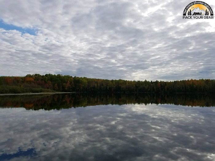
The Chequamegon Nicolet National Forests are located in Wisconsin’s Northwoods. The name Chequamegon derives from the Chippewa Indian language and means “place of shallow water.”
The reference is to Chequamegon Bay, extending from Ashland into Lake Superior.
Explore Chequamegon’s 845,000 acres any season of the year and discover its many lakes, rivers, and streams; pine, spruce, maple, aspen, and balsam forests; and extensive jack pine plantations.
Agency Name:
USDA Forest Service
Directions
Spread over a wide portion of northern Wisconsin, access is varied. Our locator map can help get you oriented.
Geographic Location
Contact Info
1170 4th Avenue South
Park Falls, WI
54552
Near By Parks
- Agate Falls Scenic Site
- Lake Gogebic State Park
- Porcupine Mountains State Park On Lake Superior
- Iron River National Fish Hatchery Complex
- Ottawa Visitor Center
- Whittlesey Creek National Wildlife Refuge
- Apostle Islands National Lakeshore
- Ottawa National Forest
Near By Campgrounds
- Black River Harbor Pavilion (MI)
- Sylvania Wilderness Bctry Camp (MI)
- Amnicon Falls State Park
- Beaver Lake (WI)
- Big Bay State Park
- Black Lake (WI)
- Brunet Island State Park
- Chippewa (WI)
- Copper Falls State Park
- Council Grounds State Park
- Day Lake (WI)
- East Twin (WI)
- Eastwood (WI)
- Franklin Lake (WI)
- Hayward KOA
- Lake Three (WI)
- Lake Wissota Sp
- Lost Lake Cabins (WI)
- Mineral Lake (WI)
- Moose Lake (WI)
- Morgan Lake Group Camp Site (WI)
- Namekagon (WI)
- Newman Lake Shelter (WI)
- Northern Highland American Legion State Forest Clear Lake Area
- Northern Highland American Legion State Forest Crystal Lake Area
- Pattison State Park
- Picnic Point (WI)
- Rib Mountain State Park
- Sailor Lake (WI)
- Sailor Lake Pavilion (WI)
- Smith Rapids (WI)
- Smith Rapids Pavilion (WI)
- Spearhead Point (WI)
- Spearhead Point Shelter (WI)
- Turtle Flambeau (WI)
- Twin Lakes (WI)
- Two Lakes (WI)


![How To Pick The Best Camper Levelers? [An Ultimate Buyer’s Guide] Best Camper Levelers](https://packyourgear.com/images/Best-Camper-Levelers-100x70.jpg)


