Lake Shelbyville
Park Information
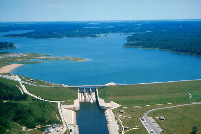
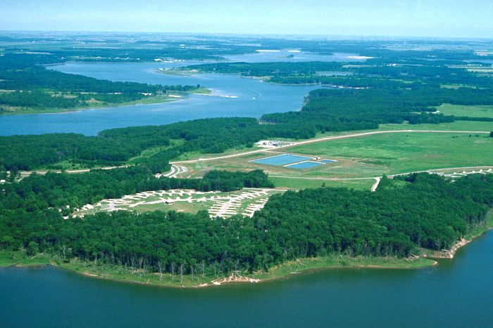
Lake Shelbyville, located in central Illinois, offers beaches, hiking trails, marinas, boat ramps, and over 1500 campsites.
The US Army Corps of Engineers, the Illinois Department of Natural Resources, and four private concessionaires have partnered together to provide a variety of recreational facilities on this 11,100 acre lake and the over 23,000 acres of land that surrounds it.

Combine the natural beauty of the area with the numerous outdoor recreational opportunities and Lake Shelbyville becomes an ideal vacation spot for people of all ages.
Agency Name:
US Army Corps of Engineers
Directions
113 miles E of St. Louis, MO – 208 miles SW of Chicago, IL – 56 miles SE of Springfield, IL – 67 miles SW of Champaign, IL – 31 miles S of Decatur, IL – 87 miles W of Terre Haute, IN – Interstate 57 and 70 provide major access to the area. IL Route 16 provides access on the south side, IL Route 121 on the north side, IL Route 128 on the west side, and IL Route 32 on the east side.
Geographic Location
Contact Info
RR 4 BOX 128B
Shelbyville, IL
62565-9804
Near By Parks
- George Rogers Clark National Historical Park
- Jefferson National Expansion Memorial
- Lincoln Home National Historic Site
- Clark County Museum
- Carlyle Lake
- Westville Lake
- Chautauqua National Wildlife Refuge
- Emiquon National Wildlife Refuge
Near By Campgrounds
- Beaver Dam State Park
- Benton KOA
- Boulder Rec. Area (IL)
- Casey KOA
- Clinton Lake State Recreation Area
- Coles Creek Day Use (IL)
- Coles Creek Rec Area (IL)
- Coon Creek (IL)
- Dale Miller Youth (IL)
- Dam East (DAY USE) (Il)
- Dam East Rec. Area (DAY USE) (Il)
- Dam East Spillway (DAY USE) (Il)
- Dam West (DAY USE) (Il)
- Dam West Area (DAY USE) (Il)
- Dam West Day Use (IL)
- Dam West Rec. Area (CAMP AND DAY) (Il)
- Dam West Spillway (IL)
- Eagle Creek State Recreation Area
- Edward Madigan State Fish And Wildlife Area
- Eldon Hazlet State Recreation Area
- Forrest W. Bo Wood (DAY USE) (Il)
- Forrest W. Bo Wood (IL)
- Fox Ridge State Park
- Frank Holten State Recreation Area
- Gun Creek (IL)
- Hamilton County State Fish And Wildlife Area
- Hidden Springs State Forest
- Horseshoe Lake Madison State Park
- Jim Edgar Panther Creek State Fish And Wildlife Area
- Keyesport Rec. Area (IL)
- Kickapoo State Recreation Area
- Lincoln Trail State Park
- Lithia Springs (IL)
- Lone Point (DAY USE) (Il)
- Lone Point (IL)
- Mcnair Group Area (IL)
- Moraine View State Recreation Area
- North Marcum Day Use Area (IL)
- North Sandusky Campground (IL)
- North Sandusky Day Use (IL)
- Opossum Creek (IL)
- Pere Marquette State Park
- Ramsey Lake State Recreation Area
- Red Hills State Park
- Sam Dale Lake State Fish And Wildlife Area
- Sam Parr State Fish And Wildlife Area
- Sand Ridge State Forest
- Sangchris Lake State Recreation Area
- Shagbark Group Area (IL)
- South Marcum Campround (IL)
- South Marcum Day Use (IL)
- South Sandusky Campground (IL)
- South Sandusky Day Use (IL)
- Spillway (IL)
- Stephen A. Forbes State Recreation Area
- Walnut Point State Park
- Washington County State Recreation Area
- Wayne Fitzgerrell State Recreation Area
- Weldon Springs State Park
- Wilborn Creek (GROUP CAMP) (Il)
- Wolf Creek State Park
- World Shooting Complex
- Horseshoe Lakes
- Raccoon Sra
- Shades
- Shakamak
- Terre Haute KOA
- Turkey Run
- St. Louis N.E. I 270 Granite City KOA
- Bootleg (UT)
- Cats Paw Camp (UT)


![How To Pick The Best Camper Levelers? [An Ultimate Buyer’s Guide] Best Camper Levelers](https://packyourgear.com/images/Best-Camper-Levelers-100x70.jpg)


