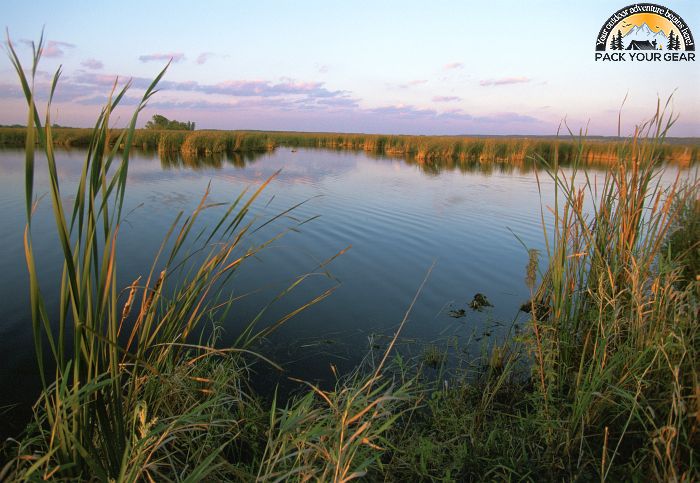
Horicon National Wildlife Refuge
Park Information
Over 21,000 acres in size, Horicon National Wildlife Refuge is located on the west branch of the Rock River in southeastern Wisconsin and encompasses the northern two-thirds of Horicon Marsh.
Horicon Marsh is a shallow, peat-filled lakebed gouged out by the Wisconsin Glacier about 12,000 thousand years ago. The headwaters of the Rock River, Horicon Marsh is 14 miles long and three-to-five miles wide.
Branches of the Rock River, small and intermittent streams, and groundwater springs provide the water resources for the marsh. At 32,000 acres in size, it is the largest freshwater cattail marsh in the United States. In 1990, Horicon Marsh was designated a “Wetland of International Importance” by the Ramsar Convention.
It has also been designated as a “Globally Important Bird Area” by the American Bird Conservancy and a unit of the Ice Age National Scientific Reserve. Major land types identified on the refuge include wetland (about 17,000 acres), of which the majority is classified as deep, freshwater marsh, and upland (about 4,000 acres), including grassland habitat.
Up to 200,000 Canada geese stage on the refuge on a peak day in fall. The refuge provides critical habitat for ducks, cranes, egrets, herons, marshbirds, and shorebirds as well as several endangered species.
Horicon National Wildlife Refuge supports the largest number of nesting redhead ducks in the eastern United States. Altogether, 223 species of birds call the refuge home.
Agency Name:
Fish and Wildlife Service
Directions
To reach the refuge office/visitor center from Waupun, go 7 miles east on State Highway 49 and 3.5 miles south on County Road Z. From Milwaukee, take 41 north to the Brownsville exit, go west on Highway 49 and 3.5 miles south on County Road Z. From Madison, take 151 north to Highway 49, go east to County Road Z, go south 3.5 miles. From Fond du Lac, take 151 south to Highway 49, go east to County Z, go south 3.5 miles. We strongly suggest that you consult an atlas or Dodge County map when using these directions.
Geographic Location
Contact Info
W4279 Headquarters Road
Mayville, WI
53050
Near By Parks
- Pike Lake State Park
- Ice Age National Scenic Trail
- Leopold Wetland Management District
- Necedah National Wildlife Refuge
Near By Campgrounds
- Adeline Jay Geo Karis Illinois Beach State Park
- Chain O Lakes State Park
- Lake Le Aqua Na State Recreation Area
- Moraine Hills State Park
- Pine Country
- Rock Cut State Park
- Arrowhead Resort Campground
- Big Foot Beach State Park
- Blue Mound State Park
- Buckhorn
- Crystal Lake
- Devils Lake State Park
- Fond Du Lac Eden KOA
- Fremont Jellystone Park Campground
- Governor Dodge
- Harrington Beach State Park
- Hartman Creek State Park
- High Cliff State Park
- Kettle Moraine Sf Southern Unit
- Kettle Moraine Sf(NORTHERN 1)
- Kettle Moraine Sf(NORTHERN 2)
- Kettle Moraine Sf(NORTHERN 3)
- Kohler Andrae State Park
- Lake Kegonsa
- Madison KOA
- Mill Bluff State Park
- Mirror Lake State Park
- Nascar Rv Resort At Westward Ho
- New Glarus Woods State Park
- Oakdale KOA
- Pike Lake Unit Kel Moraine Sf
- Plymouth Rock Rv
- Point Beach State Forest
- Richard Bong State Recreation Area
- Roche A Cri State Park
- Rocky Arbor State Park
- Sandhill Station Campground
- Wildcat Mountain State Park
- Wisconsin Dells KOA
- Yellowstone Lake State Park
- Yukon Trails Rv Resort


![How To Pick The Best Camper Levelers? [An Ultimate Buyer’s Guide] Best Camper Levelers](https://packyourgear.com/images/Best-Camper-Levelers-100x70.jpg)


