Saint Pauls Church National Historic Site
Park Information
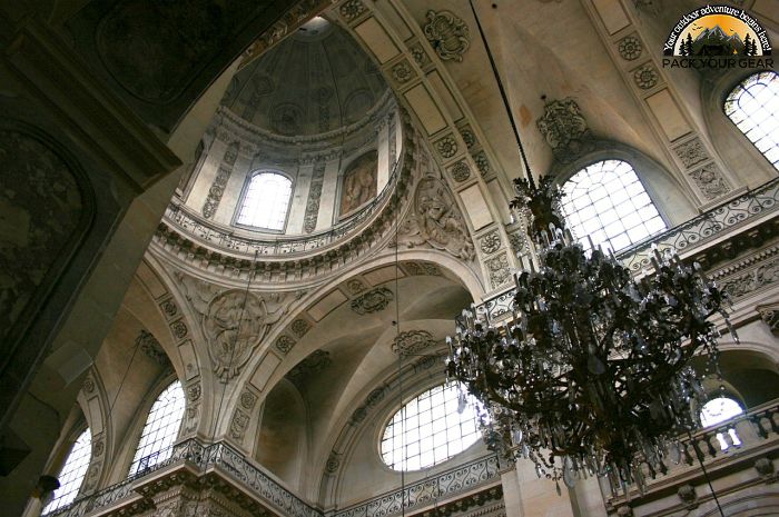
This 18th-century church is one of New York’s oldest parishes (1665-1980). It was used as a hospital following the important Revolutionary War Battle at Pell’s Point in 1776, and was the scene of various military developments for the next six years.
The church stood at the edge of Eastchester village green, the site of the “Great Election” (1733), which raised the issues of Freedom of Religion and Press.
The adjoining cemetery contains burials dating from 1704. Increasing industrialization of the area around St. Paul’s Church in the early 20th century led to the decline of the parish.
In 1942, as part of an effort to revitalize the congregation and draw attention to the site’s historical significance, the interior of the church was restored to its 18th century appearance, based on the original pew plan of 1787.
A committee chaired by Sara Delano Roosevelt, mother of President Franklin Delano Roosevelt, raised funds for the project. While the restoration initially succeeded in reviving the congregation, by the 1970s the parish had dwindled to only a handful of worshippers.

The last regular Sunday service at St. Paul’s occurred in May 1977. In 1980, the site was transferred from the Episcopal Dioceses of New York to the National Park Service. The site opened to the public in 1984 and is operated under a cooperative agreement with the Society of the National Shrine of the Bill of Rights at Saint Paul’s Church, Eastchester.
Agency Name:
National Park Service
Directions
Car – Take Interstate 95 to Exit #13, Conner Street, which is in the northern Bronx. Turn onto Conner Street. This would be a right if you’ve exited from I-95 South. If you’ve exited from I-95 North, make a left at the first traffic light off the exit onto Tilloston Avenue, and then a left at the next light, onto Conner Street. Proceed north on Connor Street about 1 mile. Conner changes names to Provost Street and, as you pass into Westchester County, it becomes South Third Avenue. About 1/4 miles after it becomes South Third, make a right at the Stop sign — the Salvation Army is on the right corner — onto So. Columbus Avenue. Then make a right into the St. Paul’s driveway, which is just past the Salvation Army. Passenger Cars Only: Hutchinson River Parkway to Exit #7 (Boston Post Rd.), and then follow signs to the site. FREE PARKING IS AVAILABLE AT THE SITE.
Public Transportation – By train: Lexington Ave IRT #5 Subway to Dyre Ave Station (Bronx). Service provided 7 days a week. By Bus: Route W-55 operates half-hourly from Dyre Ave station to St. Paul’s Church. Or, walk north to E. 233rd Street, and make a right, going east on E. 233rd. Walk several blocks to Provost, and make a left onto Provost, heading north. Provost becomes S. 3rd Ave. Continue north on S. 3rd Ave., until Stop sign on right, at Salvation Army. Make a right at Stop sign, onto S. Columbus Ave. St. Paul’s will be on your right on S. Columbus. Walk from the subway to the site should be about 15 minutes, approximately 2/3 of a mile.
Geographic Location
Contact Info
897 South Columbus Avenue
Mount Vernon, NY
10550
Additional Info
- “News – Saint Paul’s Church National Historic Site (U.S. National Park Service)”. Accessed July 02, 2020. Link.
Near By Parks
- National Parks of New York Harbor
- Hunt Hill Farm
- Delaware National Scenic River
- Delaware And Lehigh National Heritage Corridor
- Deshler Morris House
- Delaware Water Gap National Recreation Area
- Edgar Allan Poe National Historic Site
- Edison National Historic Site
- Ellis Island National Monument
- Eleanor Roosevelt National Historic Site
- Federal Hall National Memorial
- Fire Island National Seashore
- Gateway National Recreation Area
- General Grant National Memorial
- Gloria Dei Church National Historic Site
- Hamilton Grange National Memorial
- Home Of Franklin D Roosevelt National Historic Site
- Independence National Historical Park
- Lower East Side Tenement Museum National Historic Site
- Morristown National Historical Park
- New Jersey Pinelands National Reserve
- Sagamore Hill National Historic Site
- Statue Of Liberty National Monument
- Thaddeus Kosciuszko National Memorial
- Theodore Roosevelt Birthplace National Historic Site
- Vanderbilt Mansion National Historic Site
- Weir Farm National Historic Site
- Hudson River National Estuarine Research Reserve
- Jacques Cousteau National Estuarine Research Reserve
- Manhattan Sites
- Museum of American Financial History
- National Museum Of Industrial History
- The Jazz Museum In Harlem
- The African American Museum In Philadelphia
- Western Connecticut State University
- Shawangunk Grasslands National Wildlife Refuge
- Seatuck National Wildlife Refuge
- Elizabeth A. Morton National Wildlife Refuge
- Governors Island National Monument
- Lincoln Park Coast Cultural District
- Historic Bethlehem Partnership Inc.
- Great Swamp National Wildlife Refuge
- Oyster Bay National Wildlife Refuge
- Stewart B. Mckinney National Wildlife Refuge
- Target Rock National Wildlife Refuge
- Wallkill River National Wildlife Refuge
- Wertheim National Wildlife Refuge
- Success Lake
- Cooper Hewitt National Design Museum
- Huntington State Park
- Appalachian National Scenic Trail
- Castle Clinton National Monument
- Aylesworth Creek Lake
- Beltzville Lake
- Prompton Lake
- Colebrook River Lake
- Hancock Brook Lake
- Hop Brook Lake
- Northfield Brook Lake
- Thomaston Dam
- Delaware Lake
- Union City Dam
- Amagansett National Wildlife Refuge
- Elizabeth A. Morton Nwr
Near By Campgrounds
- American Legion Sf (HAWES)
- Black Rock Picnic Shelter
- Black Rock State Park
- Burr Pond Picnic Shelter
- Chatfield Picnic Shelters
- Day Pond Picnic Shelter
- Dennis Hill Picnic Shelter
- Devils Hopyard
- Devils Hopyard Picnic Shelter
- Dinosaur State Park Picnic Shelter
- Hammonasset Beach State Park
- Hammonasset Picnic Shelter
- Housatonic Meadows State Park
- Indian Well Picnic Shelter.
- Kettletown State Park
- Lake Waramaug State Park
- Macedonia Brook Picnic Shelter
- Macedonia Brook State Park
- Northfield Brook Lake (CT)
- Osbornedale Picnic Shelter
- Penwood Picnic Shelter
- People&Amp;Apos;S Forest Picnic Shelter
- Rocky Neck Picnic Shelter
- Rocky Neck State Park
- Sleeping Giant Picnic Shelter
- Southford Picnic Shelter
- Stratton Brook Picnic Shelter
- Wharton Brook Picnic Shelter
- Beartown State Forest
- Granville State Forest
- Tolland State Forest
- Chestnut Lake Rv
- Beaver Pond Campsite
- Beaverkill
- Camp Gateway (NY)
- Camp Waubeeka
- Clarence Fahnestock State Park
- Cold Brook
- Devils Tombstone Campground
- Hither Hills State Park
- Kenneth L. Wilson
- Lake Taghkanic
- Little Pond Campground
- Mills Norrie State Park
- Mongaup Pond
- Newburgh New York City North KOA
- North South Lake Campground
- Roundout Valley Rv
- Saugerties Woodstock KOA
- Sebago Cabins
- Taconic (COPAKE FALLS)
- Taconic State Park (RUDD POND AREA)
- Wildwood State Park
- Woodland Valley
- Delaware Water Gap Pocono Mountain KOA
- Scotrun Campground
- Timothy Lake North


![How To Pick The Best Camper Levelers? [An Ultimate Buyer’s Guide] Best Camper Levelers](https://packyourgear.com/images/Best-Camper-Levelers-100x70.jpg)


